DCF vs. Silnylon

In this post and the accompanying video, I’m comparing the longevity of DCF (Dyneema Composite Fabric) and silicone-coated nylon shelters. To do this, I’m going to take a look at two Mountain Laurel Designs shelters, one made of DCF and the other made of 30 denier silnylon, to see how they’ve faired over the years.
Uinta Highline Trail Guide
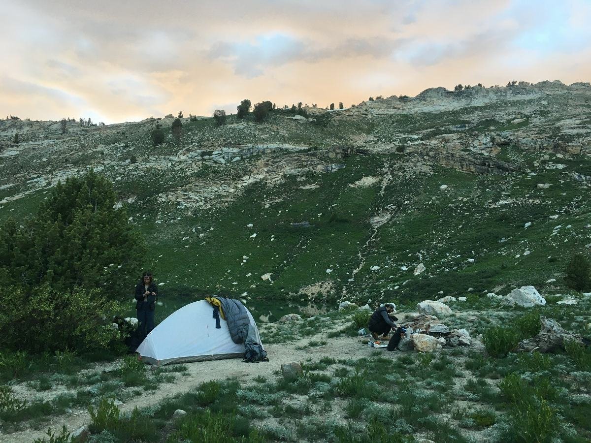
The Uinta Highline Trail is a 104-mile trail that runs along the Uinta Mountain Range in Utah’s Ashley National Forest and Wasatch-Cache National Forest. The trail is noted for its expansive views and varied terrain, which includes lodgepole forest, glacial valleys, alpine lakes, and high mountain passes. The trail has an average elevation of 10,700′; it crosses eight mountain passes that are over 11,000′, requiring 16,700′ of elevation gain end-to-end. The trail’s highpoint is Kings Peak at 13,528′.

Superior Wilderness Designs Long Haul 50 Review
Seek Outside Eolus Modifications
With this modification, I made my Seek Outside Eolus much more adaptable to variable terrain and different pitch heights. It also allows me to pitch this tent faster.
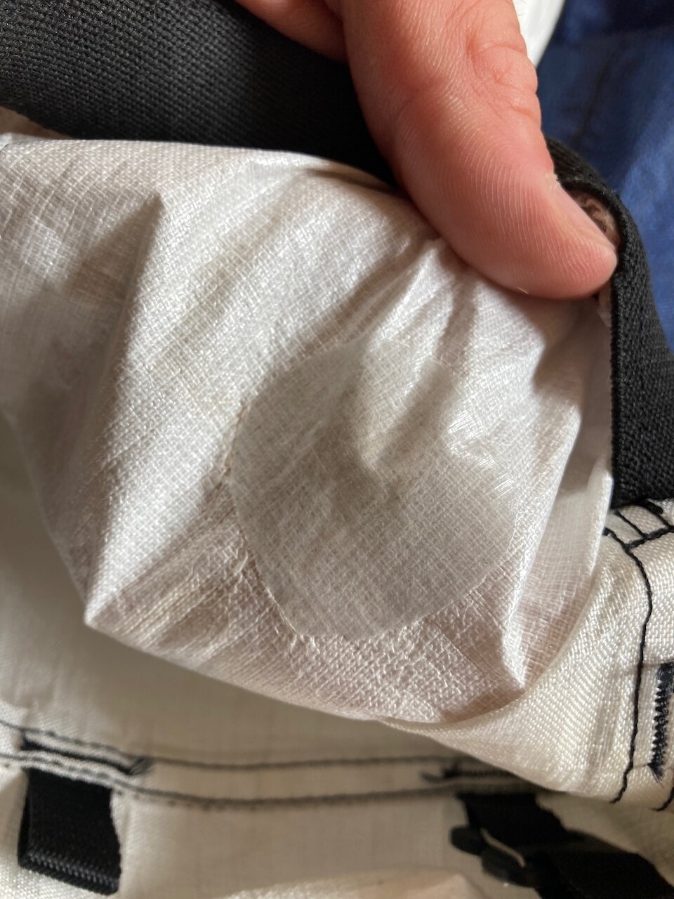
Patching Experiments on EPL200 Ultra Fabric
I have patched two intentional holes in the EPL200 Ultra front pocket of my Superior Wilderness Designs Long Haul 50. I will keep an eye on the patches as I continue to use the pack then and report back here to let folks know how they’re holding up.

I call this the Baloo Maneuver. Scraped up and down pretty hard like 12 or 15 times.

Abrasion resulting from Baloo maneuver

Even got a tiny hole

Cut a piece of Tear Aid for the inside
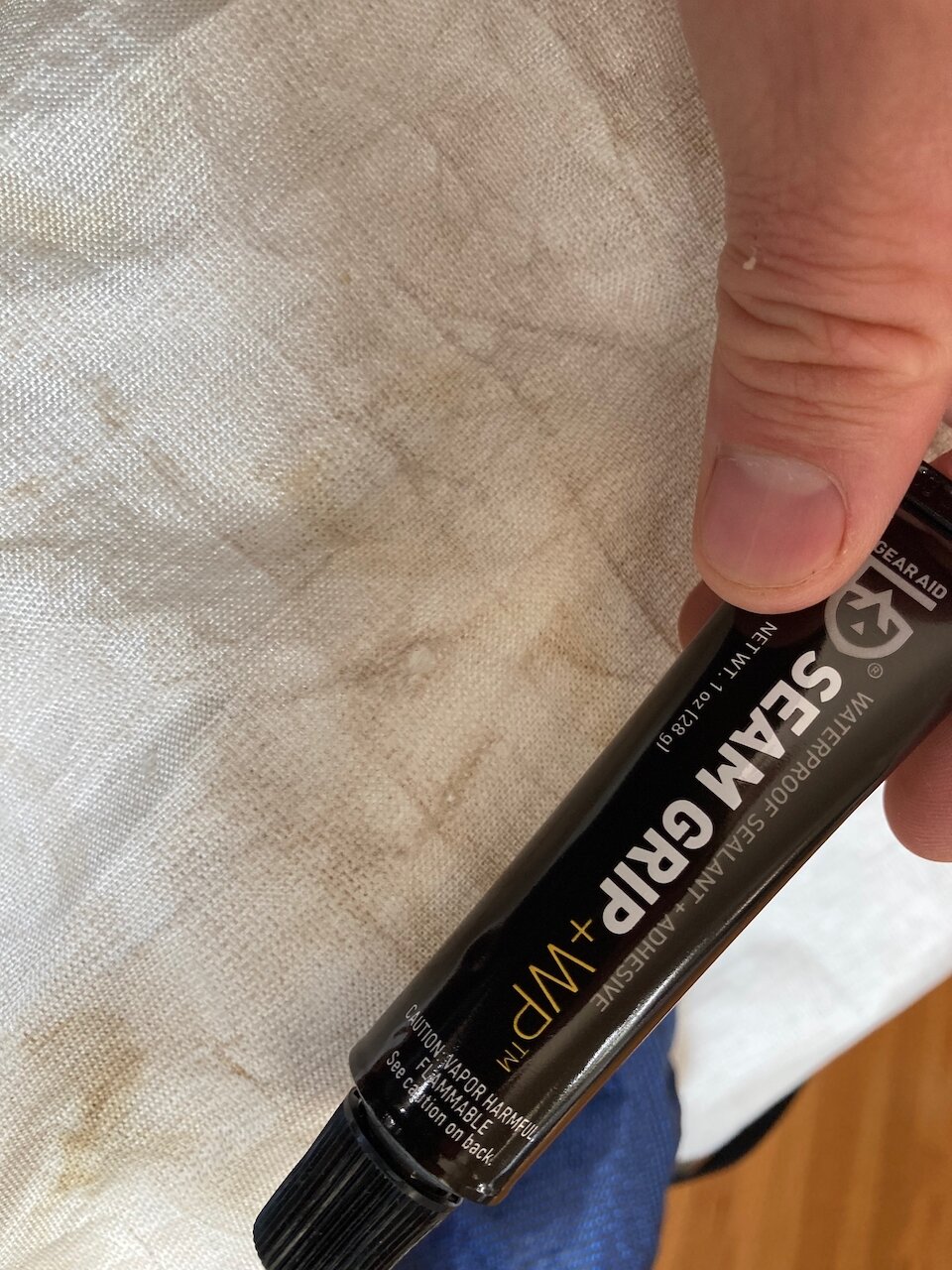
Used seam grip on the outside

The finished repair. Ugly because of the blue patch behind.

Scraped with a sharp rock for 25 minutes while watching Deep Space Nine resulting in this abrasion/hole

Cut a piece of DCF tape for the inside
DCF tape inside

Applied Aquaseal to the outside

Finished repair looks pretty good. I like how the Aquaseal fills in the abrasion and remains malleable. I imagine this will hold quite well.
Observing Transition Season
Leopold is arguing that the first four grades with their inherent dissociation from the land, and the relative nonexistence of the fifth among recreationists, pose a huge threat to the lands on which we recreate. The lower recreation grades,
“consume their resource base; the higher grades, at least to a degree, create their own satisfactions with little or no attrition of land or life. It is the expansion of transport without a corresponding growth of perception that threatens us with qualitative bankruptcy of the recreational process. Recreational development is a job not of building roads into lovely country, but of building receptivity into the still unlovely human mind.”
The Fire's Job
Searching for a Backpack that is Durable, Light, and Carries Heavy Loads
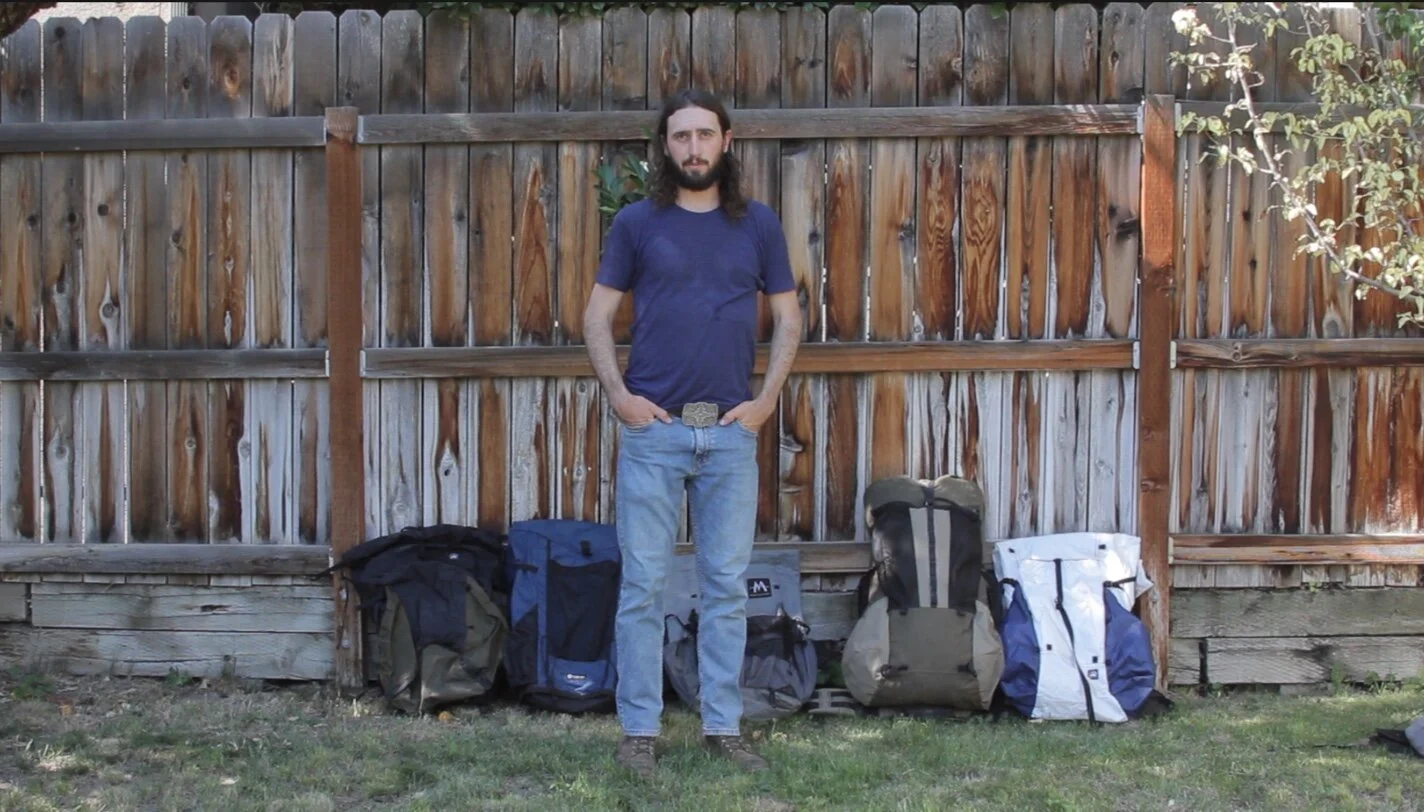
I made this video to explain why I’ve made some of the choices I’ve made as I keep on trying new backpacks.
Good Gear Lets You Be Present
Then my attention turned to the pack I was wearing. I was 11 miles into the first day of testing the YAR Gear Mountain Drifter 38 Liter pack and needed to pay attention to whether or not it was working. Suddenly aware I hadn’t spent all that much time thinking about it during those first 11 miles, I promised myself I would try and pay better attention from then on out. I hadn’t noticed undue pressure on my shoulders, hips, or back. All I really did remember from the last 11 miles were the large volcanic stones in the trail, prickly pear, agave, alligator juniper, piñon, yuccas, and countless birds. I remember the looming blue triangle of the Mazatzal Mountains dusted lightly in snow creeping slowly closer to me like one of the pyramids of Giza chained to a winch and cranked heavily across the ground. Is that how they were built? With that thought came a flood of associations. “When the great – pyramids – dragged themselves out to this spot – sickness sank into the little one’s heart,” I sang loudly, remembering the beautiful and dark Jason Molina song.
Take This Poem on Your Next Trip
“The road seen, then not seen,” begins the poem “Santiago” by David Whyte.
The road seen, then not seen, I think, walking down Woodenshoe Canyon in Bear’s Ears National Monument in late November. The red trail below my feet leads into piñon and juniper and turns and disappears within them. The path seen, then not seen. It dips into a willowy wash and is nearly gone, only seen where snake grass is occasionally matted down by past feet. The road seen, then not seen.
Gryphon Gear Aries 20 Quilt Review
The Gryphon Gear Aries 20 Quilt (25.7 oz / 729 g, MSRP from $327) is a three-season quilt with a differential cut, draft collar, an edge tensioning system, and 17.5 oz (496 g) of down fill. Its price puts it a little under the cost of similarly rated Nunatak and Katabatic quilts – its closest competitors. It is the warmest 20 °F quilt I’ve ever used.
Giving Back to Bear's Ears (Backpacking Light)
It would be my first adventure in the Bear’s Ears area. Prior to this trip (which occurred in my early 20s) I had been more interested in the simple aesthetic beauty of desert canyons. Water pouring over orange sand, and fragments of the cobalt sky reflected in it. But after a while, I started to think more deeply about places. The beauty remained, but it began to penetrate time in both directions: centuries into the past, and centuries into the future. And if a particular place — say, Coyote Natural Bridge in Coyote Gulch, for example — was here 800 years ago, who walked under it? What did it mean to them? As these questions developed, the existence of the stories of the land began to appear. But not the stories themselves, just the fact that they exist. I could start to see them, like unlabeled books on a shelf I couldn’t quite reach. First I would have to start walking and asking questions, then maybe, just maybe, a few of those layers would start to reveal themselves.
First stop: Comb Ridge.
The Anthropology of a Trail (Backpacking Light)
Who or what makes a trail?
I’ve often wondered this when veering off the Bonneville Shoreline trail that skirts the edge of Salt Lake City to investigate less distinct deer trails. The Bonneville Shoreline trail is a human trail today, no doubt, but when Lake Bonneville lapped at the shore between 30,000 and 13,000 years ago, bison, deer, and later Shoshone, Ute, Goshute, and other Native people surely walked the edge of the water. Then when the lake receded, it left a clear line, an obvious promenade just asking to be walked. So, who or what created this trail? Did the lake itself make it? After all, today’s trail is named after the lake. The existence of this question seems to speak of its own futility, or maybe trail-making or path-making are just more complex than they appear.
Superior Wilderness Designs Big Wild 70
I’ve been on a hell of a pack journey; it has been challenging to say the least to find something that is light and carries a lot of weight well. If you’ve read through some of my other posts you’ll know that I used a large HMG Porter 4400 (46oz) pack for a while, but it destroyed my shoulders. Then switched to a Seek Outside Divide 4500 which I still have and love but is heavy at 57oz. I began using a medium 32oz HMG SW 3400 modified with loadlifters for most of my three-season trips, but it still wasn’t quite cutting it. I tried the Seek Outside Flight One (38oz) briefly but I bought the wrong size (22”) and did not like the hip belt. My next pack was the Hanchor Marl (40oz) which I still have and like, but which may become obsolete with the introduction of the SWD Big Wild 70.
Frozen Tracks: Monument Restoration and the Fate of the Upper Paria (Backpacking Light)
The Grand Staircase-Escalante National Monument was designated in 1996, with its original size encompassing 1,880,461 acres. President Bill Clinton famously signed the proclamation on the South Rim of the Grand Canyon, several miles and a state away from the southern border of the new monument, an act seen by many local Utahns as cowardly, a slap in the face, and more proof that only outsiders wanted this land to hold monument status. A little over 20 years later, Trump pleased these same folks by reducing the size of the monument by about half. Now many who lamented the shrinking—locals and nonlocals alike—are anticipating President Joe Biden’s restoration of the monument to its original size. On his first day, he signed an executive order for the review of the monument boundaries. With all of this in mind, I decided to walk through an area that could be affected by whatever Biden decides to do to see if there was a story inherent in the place itself, one separate from the political division that accounts for most monument discussions.
Backpacking in a Time of Uncertainty (Backpacking Light)
Throughout the summer, despite the ongoing pandemic, an uncertain relationship, political division in the U.S., the impending election—and the possibility that it wouldn’t go smoothly—I somehow completed several multi-day backpacking trips and even the Uinta Highline Trail. I even said out loud on multiple occasions that I was actually enjoying quarantine, that I was enjoying my work routine at home, and that I liked cooking every meal every day. But by mid-September, something shifted in me.
Crossing the Water (Dark Mountain)
Just outside the town of Strawberry, Arizona we found the dirt road that would take us to Twin Buttes trailhead, where we would be leaving the truck. A creek flowed across the road, but when we drove into it we found it was shallow, demure, and proceeded south unimpeded. The road took us through junipers and oaks in the bright sun and, when we parked, I stowed my wallet somewhere in the truck and my hiking partner Jesse did the same. We’d later come to regret this decision.
The Adventurer's Son by Roman Dial
Roman Dial’s The Adventurer’s Son is a deeply honest piece of writing. Dial, a hardcore adventurer, displays admirable vulnerability in this story of family-building and loss. He examines the heart of the adventurer, how it yearns to walk the knife edge cornice between life and death while simultaneously questioning that desire, especially when it causes others pain. He grapples with the guilt of encouraging adventure in his son—also named Roman—as adventure led ultimately to his death.
The Overlook: Othering in the Outdoors (Backpacking Light)
The Overlook is Backpacking Light’s new monthly column where hiker, writer, and thinker Ben Kilbourne will explore backpacking from many different vantages. He will try to climb up to a high place with a view, an overlook, where the myriad issues intertwined with backpacking can be seen. This column will challenge the reader to embrace complexity and engage in thoughtful dialogue with other readers. Join us at The Overlook!
An Encounter
After a long workday, I closed the computer, switched from jeans to running clothes, drove up Big Cottonwood Canyon just outside of Salt Lake City, and parked on the side of the road behind a long string of cars. On a Friday afternoon, hordes of people had the same idea as me: get some exercise in the woods. It’s a common pastime for Salt Lakers of all kinds, an activity with no apparent common denominator. The Wasatch Range is a place where different people are brought together through a shared love of the outdoors.
Continue reading at Backpacking Light